
MAPA ETNO-HISTÓRICO DO BRASIL E REGIÕES ADJACENTES
Ethnohistoric Map of Brazil and Adjacent Regions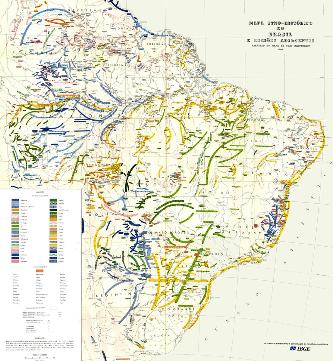
Curt Nimuendajú, Mapa etno-histórico do Brasil e regiões adjacentes
[Ethnohistoric Map of Brazil and Adjacent Regions], 1942
[Ethnohistoric Map of Brazil and Adjacent Regions], 1942
Originalmente comissionado pelo Smithsonian Institution dos Estados Unidos em 1942, este mapa foi desenhado pelo etnólogo alemão naturalizado brasileiro Curt Unckel (1883-1945), influente pesquisador e ferrenho advogado dos povos indígenas à sua época. Utilizando-se de uma extensa paleta de cores, Nimuendajú – como foi batizado pelos povos Guarani com quem conviveu – territorializa quarenta famílias linguísticas indígenas, mostrando um arco-íris da diversidade sociocultural que habita as terras que hoje chamamos de Brasil. Reconhecido pela UNESCO como patrimônio da humanidade, este mapa continua sendo utilizado por organizações indígenas como evidência da posse ancestral de seus territórios.
Originally commissioned by the Smithsonian Institution in the United States in 1942, this impressive map was drawn by Curt Unckel (1883-1945), an influential German ethnologist and staunch advocate of the Indigenous peoples of his day. Using an extensive palette of colors, Nimuendajú—as he was baptized by the Guarani people with whom he lived—territorialises forty Indigenous linguistic families, showing a rainbow of socio-cultural diversity inhabiting the lands we now call Brazil. Registered by Unesco as World Heritage, this map is still used today by Indigenous entities as evidence of the ancestral possession of their territories.